Where each office is, what to bring and in what order to do things. Electricity, water, cars, schools, taxes. And where the town comes from, when the fiestas fall, who painted here. Free, no advertising, in five languages. Not an official portal.
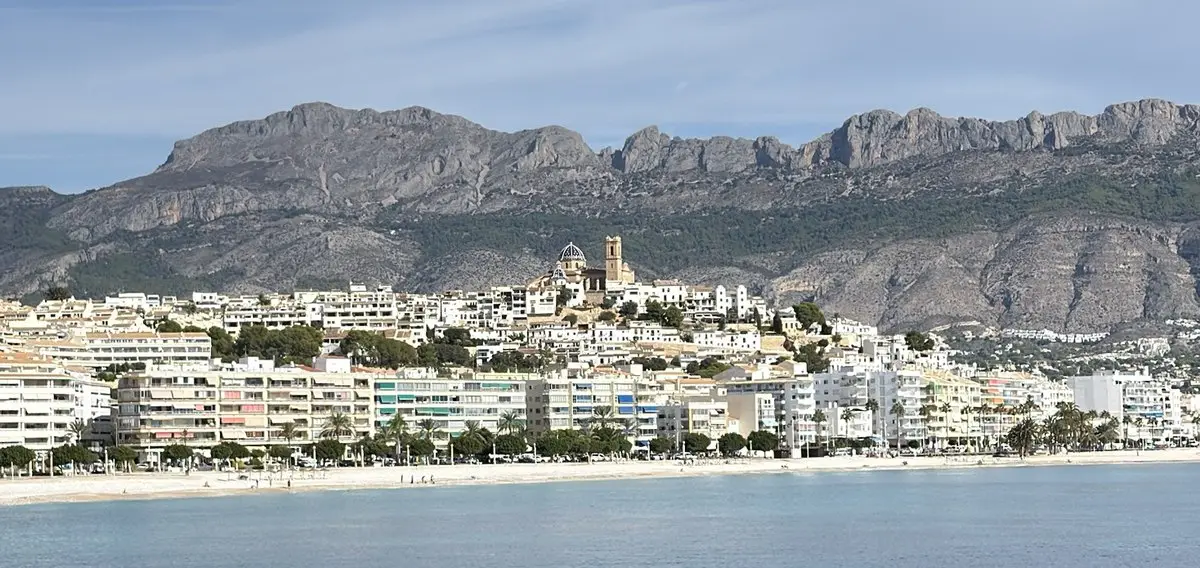
Altea from the harbour: the old-town hill with the Mare de Déu del Consol above the town beachPhoto: Axel Voigts
Whitewashed houses on a hill, and above them the blue-and-white tiled domes of the church of Mare de Déu del Consol — the image everyone associates with Altea is in fact the old town.
Altea lies in the Marina Baixa district between Benidorm and Calp, with the escarpment of the Serra de Bèrnia at its back, which shelters it from northerly winds and gives it a mild microclimate. The beaches are pebble rather than sand, and the water is correspondingly clear. Instead of towers there is a height limit, a fine arts faculty, galleries and a weekly market.
About a third of registered residents were born abroad (2019 figures, AVL). Much can be sorted out in English or German, but the administration itself works in Spanish and Valencian, and deadlines, forms and appointments follow Spanish administrative law. That is exactly where this site comes in.
The municipality divides into a compact core by the sea and widely spread residential areas on the slopes behind it. Which one suits you usually comes down to a single question: car or no car.
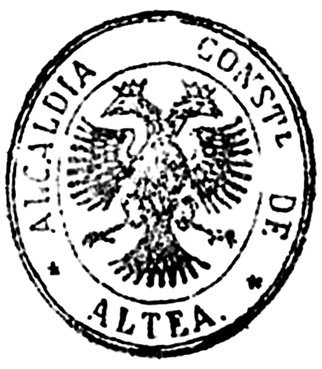
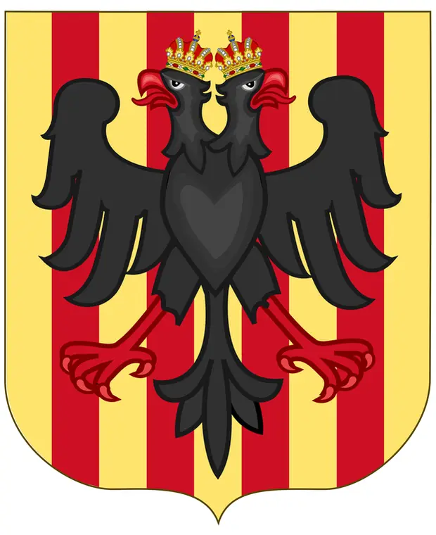
The black double-headed eagle above the four red pales of the senyera is Altea’s most conspicuous emblem — a Habsburg bird on a Mediterranean coast. Tradition traces it to 1705, when Altea took the Habsburg side in the War of the Spanish Succession. No grant is documented: on the municipal seal of 1876 the eagle stands alone, with no shield and no pales.
From the waterline to the sierra is less than ten kilometres, but a good 500 metres of altitude. That climb explains most of the differences between the areas: the view, how easily you get about, and the price.
By the waterIn the townOn the slopes and inland
By the water
Northern edge, towards Calp
Cap Negret
Pebble beach of volcanic origin, hotels and restaurants along the N-332. Mostly apartments with sea views.
More about this area
The dark headland that gives the area its name was for millennia a landmark for anyone sailing this coast. Later the same spot held a castle within the coastal defence system, its garrison supplied by inland villages — Tàrbena, Castell de Castells and Callosa. Little of it survives: the rock was quarried, and during the Civil War a machine-gun post was built there. The pebble beach has kept the name and the view.
Galera Baja, laid out in 1969, and Galera del Mar form a single area and are held to be Altea’s oldest residential estate (urbanización). Large plots, mature gardens and direct access to the sea; low density and no hurry.
Between rock faces and the marina, with its own coves and good access from the AP-7.
More about this area
The Mascarat gorge separates Altea from Calp with a cut in the rock that for centuries made any easy route between them impossible: carts had to detour over the dangerous Collado de Calpe. A fortress once stood on these crags, watching the coast and the Camino Real to Valencia, and the name probably comes from it — from the Arabic askar, soldier. Popular tradition prefers another explanation: a masked highwayman who robbed the coaches, exploiting the difficulty of the pass. The tunnels were cut in 1868 and the ashlar bridge, some sixty metres high, opened in May 1885 after years of storms and flash floods. The iron railway bridge followed, and the tunnels of today’s N-332 in the late sixties. The area is now largely residential estates and marina; the canyon itself can be walked from the bed of the ravine.
Large plots, panoramic sea and mountain views, good links to the AP-7, the marina and golf.
At the foot of the Bèrnia
Altea la Vella
Its own centre with a branch administrative office, restaurants and the Don Cayo golf club. Separated from the coast by the AP-7.
More about this area
Altea la Vella is not a new district but the origin of the municipality: this was the old main settlement, and a medieval tower stood at the highest point of the village. When the fortified town by the sea was founded in 1617, the old centre was left behind — hence the name, “the old one”. It remains a village with its own square, church and fiestas, less than four kilometres from the main town but cut off from the coast by the AP-7. Around it lie the market gardens of the Algar, with farmhouses, wells and irrigation channels still recognisable.
Each page includes the address, phone number, opening hours, responsibilities, the documents you need, the procedure step by step, common questions and a map.